5. What is the area covered by the Exmouth Beach Management Plan?
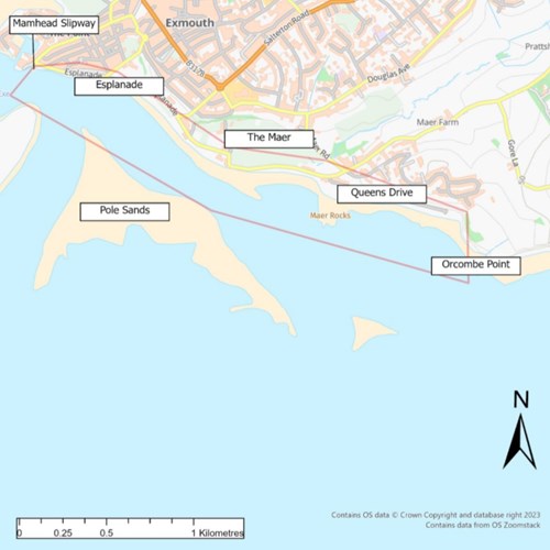
The Exmouth Beach Management Plan covers the area from Orcombe Point to Exmouth Marina, shown in the picture below.
Note, the 2015 BMP extended to Exmouth Pier, but the update is extending this western boundary to the Mamhead Slipway near to Exmouth Marina.